Welcome to one of the world’s most isolated research stations
Arctic Hub visited the American research facility, Summit Station, whose unique location atop the Greenland ice sheet helps scientists understand climate change.
By Rasmus Balle Hansen
Published on October 1, 2024
As the large, ski-equipped Hercules LC-130 aircraft begins its descent, small, colorful buildings sporadically appear on the ice sheet below.
We’ve arrived at Summit Station, operated by the U.S. National Science Foundation.
“By looking through the ice, we can learn a lot.”
– Ian Geraghty, Science Project Manager
The station is located near the apex of the ice sheet, approximately 10.530 feet above sea level and around 250 miles from the nearest point of land.
The aircraft is the only way to travel to and from the station, making it one of the most remote research facilities in the world.
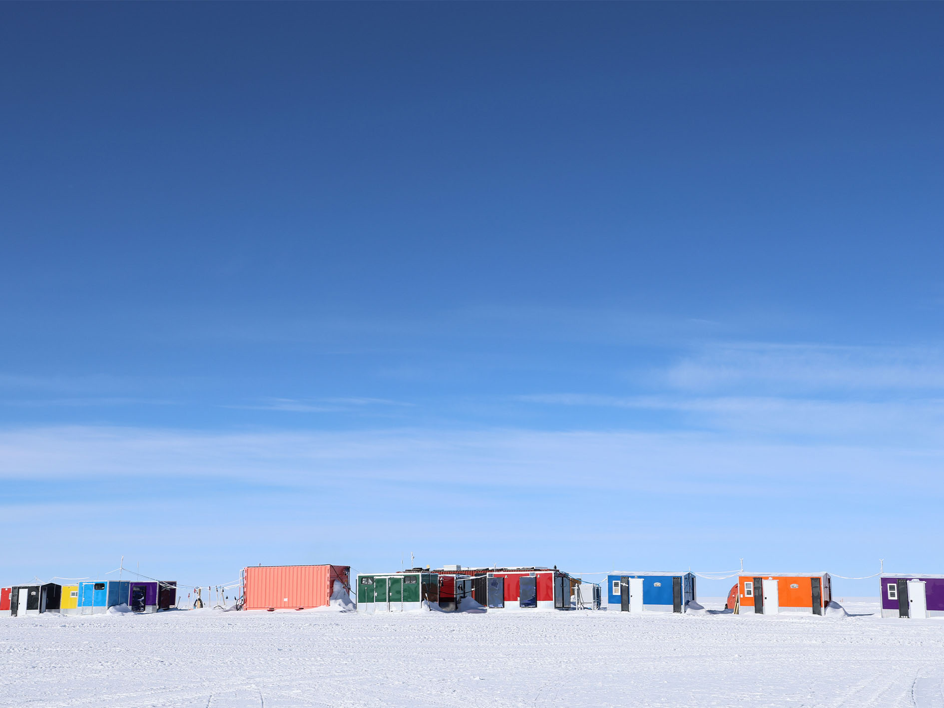
In the picture, the smaller sleeping modules, known as “the fish huts”, can be seen.
Photo by: Rasmus Balle Hansen
First impression
Summit Station consists of several large and small facilities. There’s the central building, which houses the kitchen and living room, known as “The big house,” and smaller sleeping quarters—referred to as “fish huts” in Summit lingo.
Additionally, there are many other buildings, often referred to by acronyms, comparisons, or made-up words, such as SMG (Summit Mobile Garage), AWO (Atmospheric Watch Observatory), The Flarm, Caboose, and MSF (Mobile Science Facility).
The crew
At its peak, the station can accommodate around 40 people—but preferably not for too long, as “The big house” isn’t really that big. In the winter months, there are typically only five people on site.
“Don’t breathe for the next 20 seconds.”
– Caleigh Warner
The buildings’ various functions are mirrored by the people who work here. The research conducted at the station requires different skill sets: some to carry out the science, others to maintain equipment and instruments, and, not least, those who ensure daily meals and overall well-being.
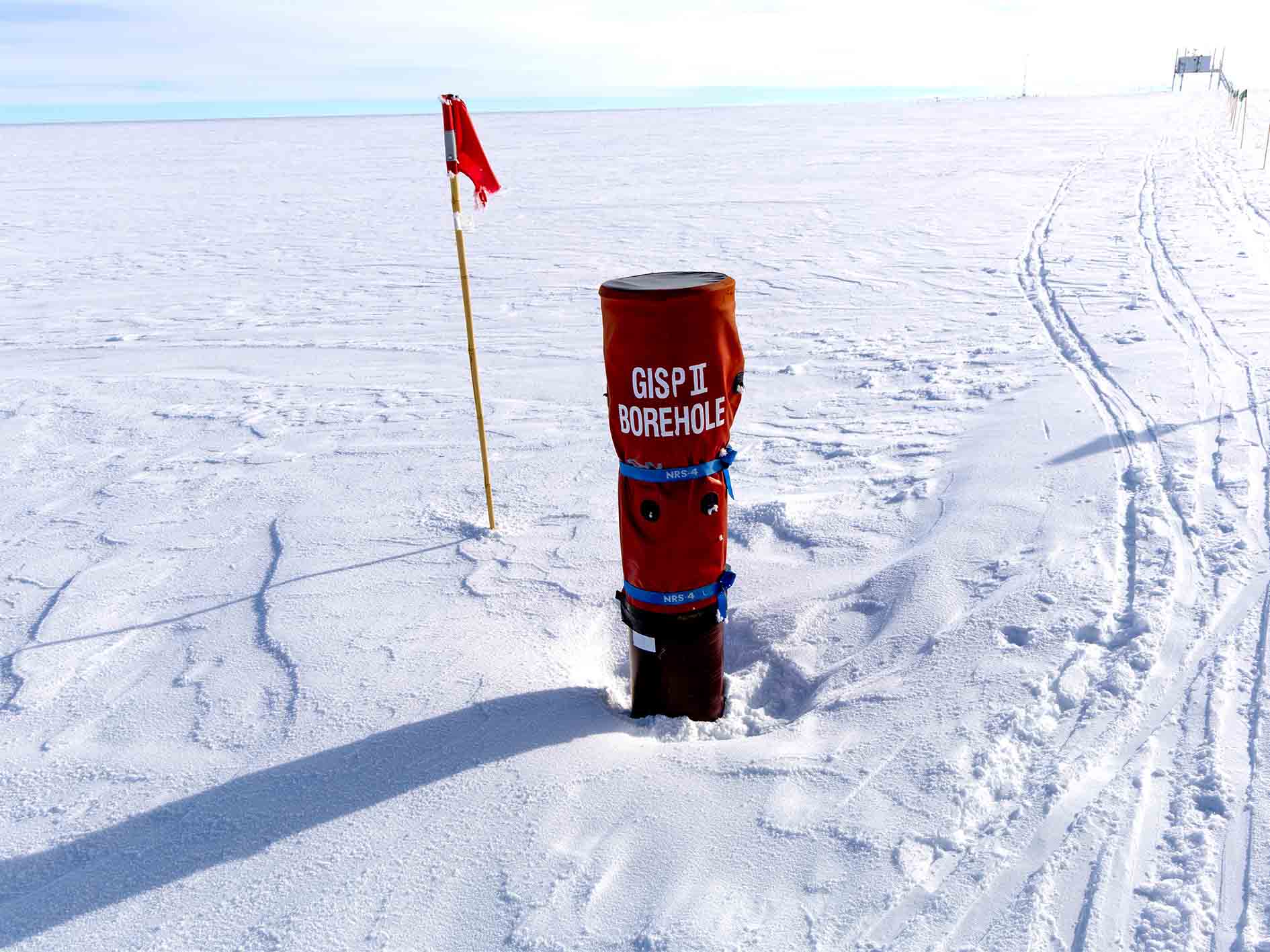
The GISP 2 borehole from the 1990s is still visible. The borehole is approximately 9,800 feet deep.
Photo by: Rasmus Balle Hansen
Stories hidden in the ice
Understanding past climates is crucial to predicting future climate changes. The three-kilometer-thick ice beneath Summit Station is the perfect place to look for answers, as the climate’s history is recorded in the ice.
Each layer of ice holds information about temperature, precipitation, and wind at the time the snow fell. The deeper researchers drill into the ice, the further back in time they can see.
“By looking through the ice, we can learn a lot, including how the atmosphere was hundreds of thousands of years ago,” says Ian Geraghty, Science Project Manager at Summit Station.
By analyzing these layers, researchers can see how the climate has changed over the last 200,000 years. This helps understand past climate conditions and predict future climate changes and their potential consequences.
Summit Station
Also known as the Greenland Environmental Observatory at Summit, was established in 1999 by the National Science Foundation. The station was built as an extension of a 1989 project called the Greenland Ice Sheet Project 2, where scientists drilled deep into the ice to gather information about past climates. The old borehole still exists at the site.
Caleigh Warner is in the process of testing the air quality. Shortly after, we are told to hold our breath.
Photo by: Rasmus Balle Hansen
Cleanest air in the world
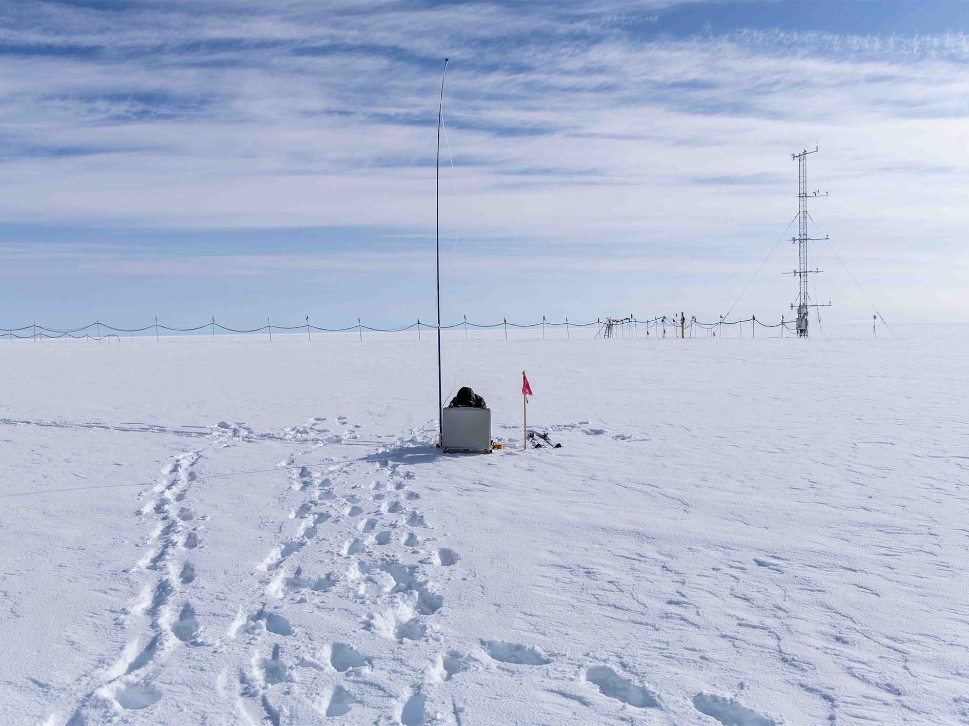
The clean air at Summit Station is another important factor. In the so-called “clean air” zone, where the air is so pure that even the smallest pollution can be detected, air quality is meticulously measured. The data is compared with readings from other locations worldwide to understand air pollution and its impact on the planet.
“This is how we get weather forecasts,”
– Sierra Dabby, Science Technician
“Hold your breath!”
Caleigh Warner, a Science Technician responsible for conducting air quality measurements, ventures out onto the ice daily, equipped with cross-country skis, to set up the measurement equipment. She carries a silver case containing two blue bottles, in which air samples are collected for later analysis.
“It’s important that the wind is blowing the right way, so the station’s emissions and vehicle exhaust don’t interfere with the measurements,” she explains.
Out on the ice, she sets up the equipment, which features an extendable pole about 8 feet tall that captures the air. Before pressing the start button, she turns around and shouts, “Don’t breathe for the next 20 seconds,” then the air sample collection begins.
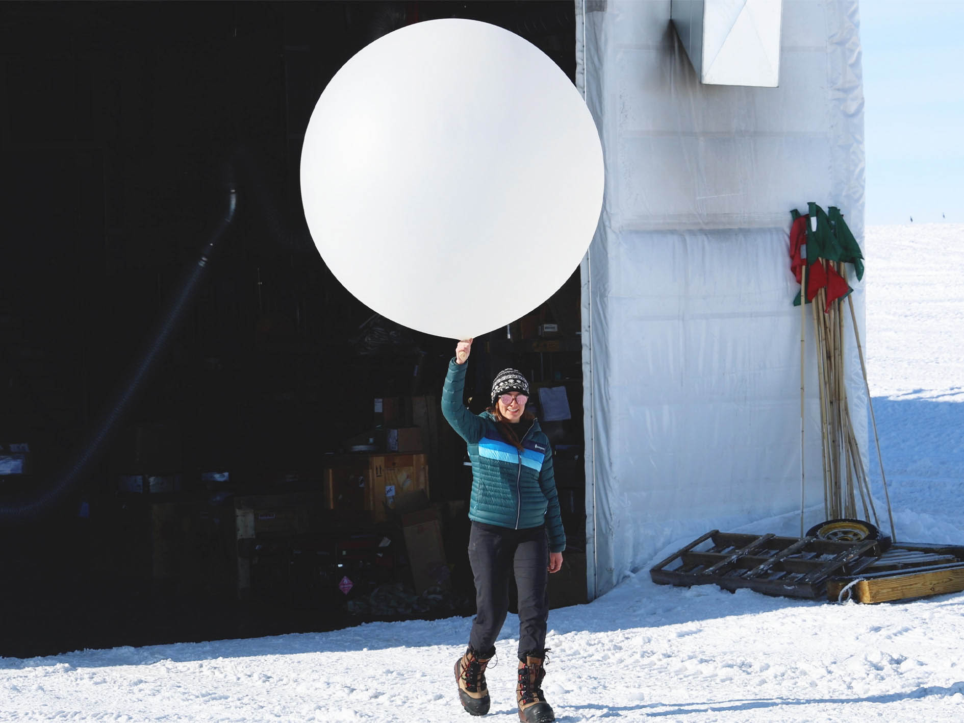
Sierra Dabby is on her way to launch the first weather balloon.
Photo By: Rasmus Balle Hansen
Forecasts from the atmosphere
While air can tell us about pollution, at Summit Station, it also serves another crucial purpose: to provide information about weather conditions.
Twice a day, a radiosonde is attached to a large white balloon and sent approximately 18-22 miles up into the atmosphere. As it ascends, it collects data on weather, wind conditions, and climate, sending the information back to the station. This data is used worldwide for weather forecasts, planning flight routes, and studying long-term climate patterns.
“This is how we get weather forecasts,” says Sierra Dabby, a Science Technician at Summit Station, who has just launched the balloon into the sky.
Weather balloons
Are about 130-150 centimeters in diameter when launched and weigh approximately 700 grams. They can fly up to 35 kilometers before bursting. Globally, there are 800 locations that launch balloons twice a day, at 11:00 AM and 11:00 PM UTC. These launches help provide an overall picture of wind, weather, and jet streams, which are important for understanding how the atmosphere functions.
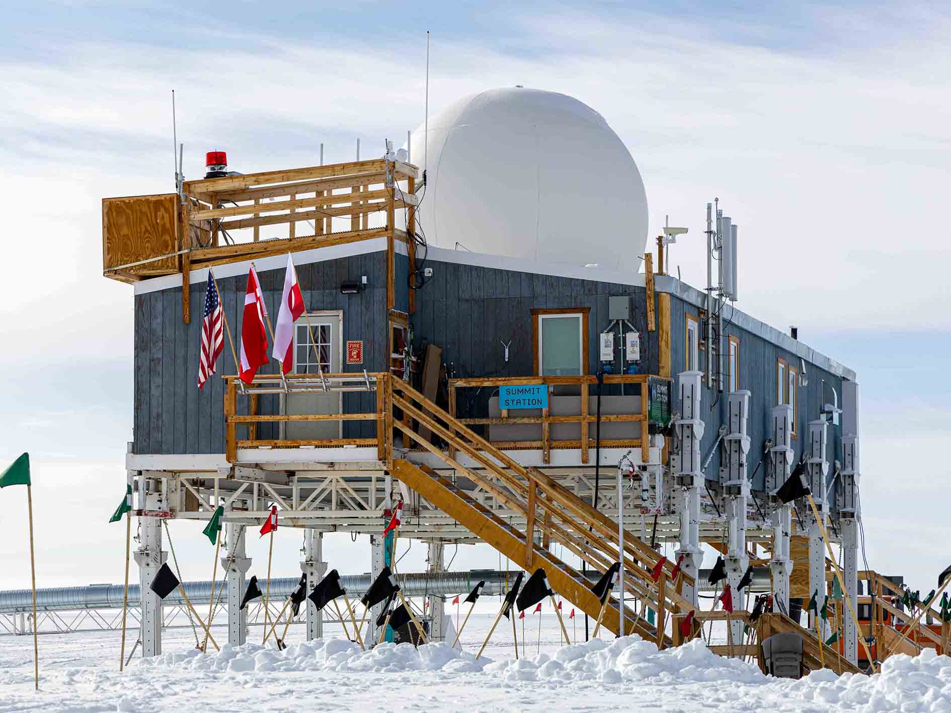
Summit Station with Erfalasorput, Dannebrog, and the Stars and Stripes.
Photo by: Rasmus Balle Hansen
More than a borehole
Since the first borehole was drilled at Summit Station back in 1989, the station has expanded and evolved significantly. It now supports a wide range of scientific projects, including meteorology, glaciology and astrophysics.
In the video at the top of this article, you can take a tour of the station and learn how the research conducted atop the Greenland ice sheet contributes to our understanding of both local and global climates.
Arctic Hub’s visit to Summit Station was part of the National Science Foundation’s Polar Media Program.