Landslide risk – increased monitoring to ensure safety
A new report from the Department of Mineral Resources shows that there is still a risk of landslides in the Uummannaq Fjord system. However, geologists say that increased monitoring of the mountains will allow for early warnings.
By Rasmus Balle Hansen
Published on September 2, 2024
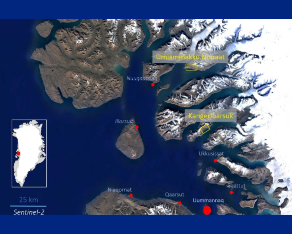
After two years of research and data collection from monitoring systems in Umiammakku Nunaat and Kangerluarsuk, the Geological Department, which is part of the Department of Industry, Trade, Mineral Resources, Justice, and Gender Equality within the Government of Greenland, has gained new insights into potential landslides.
Although landslides continue to pose a risk in the area, the geologists’ new report indicates that the size of a following tsunami is expected to be significantly lower than previously estimated.
Unstable cliff requires increased attention
An unstable cliff east of the 2017 landslide has been discovered. This cliff, called “2017 kangilleq,” presents a particular risk and was previously unknown. Therefore, the area will be subject to further monitoring in the coming years.
“Due to the natural disaster in Uummannaq Fjord, we have become more aware of the risk of landslides. That’s why we have observation posts equipped with cameras, earthquake sensors, and GPS, from which we obtain important information about the mountains,” says Jonas Petersen, a geologist at the Geological Department.
“It’s hard to say definitively whether there will be more landslides over the next 100 years,”
– Jonas Petersen
Fieldwork in the area will continue throughout 2024, and this new knowledge will further contribute to improving risk assessments.
Future landslides
The mountains around us are not on the verge of collapsing, and when a landslide occurs, it is often a development that takes place over a long period. However, geologists believe that there may be a link between climate change and how it affects permafrost, which could increase the risk of landslides in the future. For this reason, there are plans to expand monitoring to the rest of the country in the coming years.
“It’s hard to say definitively whether there will be more landslides over the next 100 years, but it may happen more frequently in areas affected by climate change,” says Jonas Petersen.
What is permafrost?
Permafrost is soil that remains frozen all year round for at least two years. This means that the temperature in the ground does not rise above freezing, even during the summer.
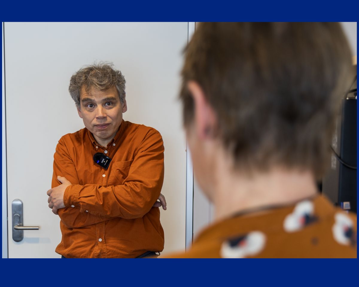
Jonas Petersen with his colleague Eva Mätzler from the Geological Department.
Photo: Rasmus Balle Hansen
Alarm system to enhance safety
One thing is being aware of the risk of landslides; another is being able to alert the local population. Currently, the department can warn of an expected landslide, but they also aim to create more immediate warning systems for landslides that may not be easily predicted.
The geologists at the Department of Mineral Resources are currently involved in two research projects focused on developing and implementing an alarm system that can instantly warn residents in vulnerable settlements—such as through SMS—in case of an emergency.
However, developing such an alarm system is proving to be a challenge. Due to the nature of the terrain around the mountains, it is difficult to construct a system that can withstand the weather conditions. Nevertheless, geologists and researchers remain optimistic about finding a solution that can be used in Greenland.
Read the full report by Jonas Petersen and his colleagues, Eva Mätzler and Alexander Philip Gamble, from the Geological Department here.
Learn more about landslides here.